01 — Training & Validation
Loss and F1-score across 10 epochs.

A deep-learning land-use and land-cover classifier built on Sentinel-2 EuroSAT imagery. The ResNet18 architecture was modified for the native 64×64 resolution (3×3 conv1, no MaxPool) and trained with augmentation and transfer learning, reaching 98% test accuracy across 10 classes.
Loss and F1-score across 10 epochs.
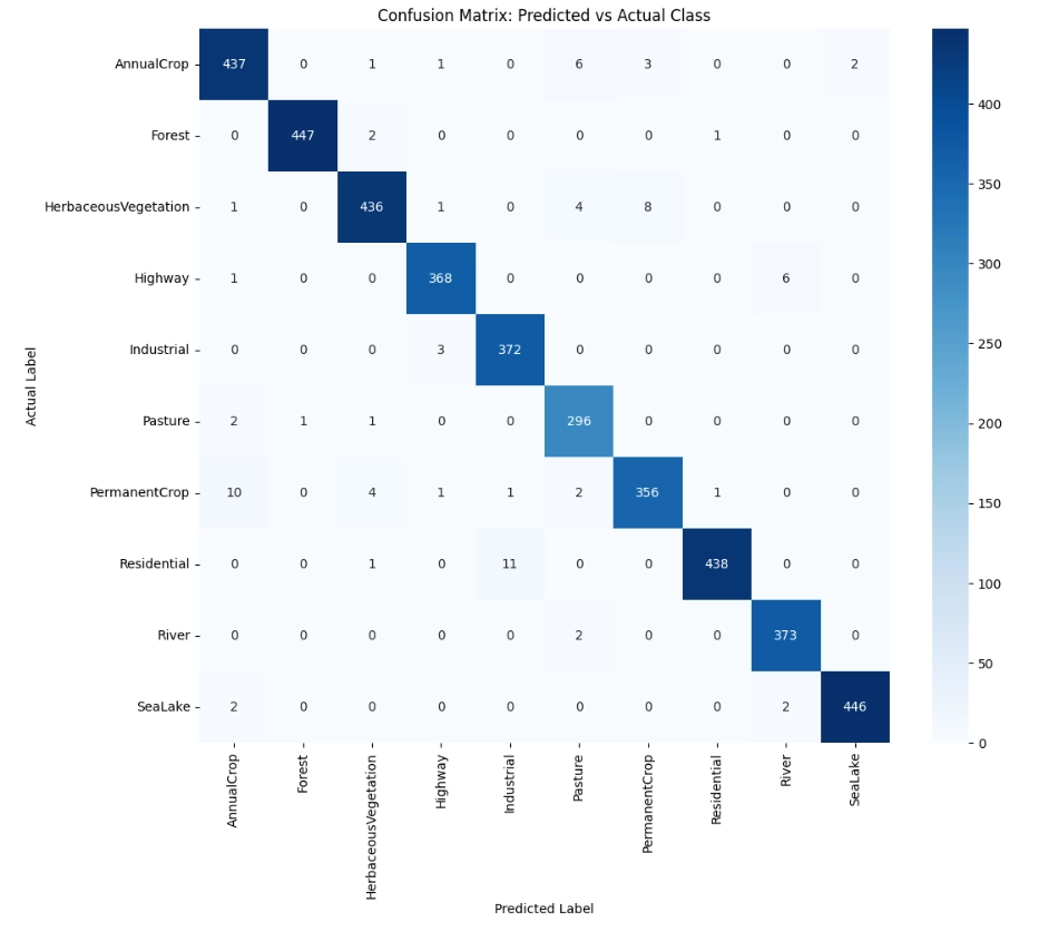
Predicted vs actual class on the held-out test set.
Per-class metrics, observations, and challenges.
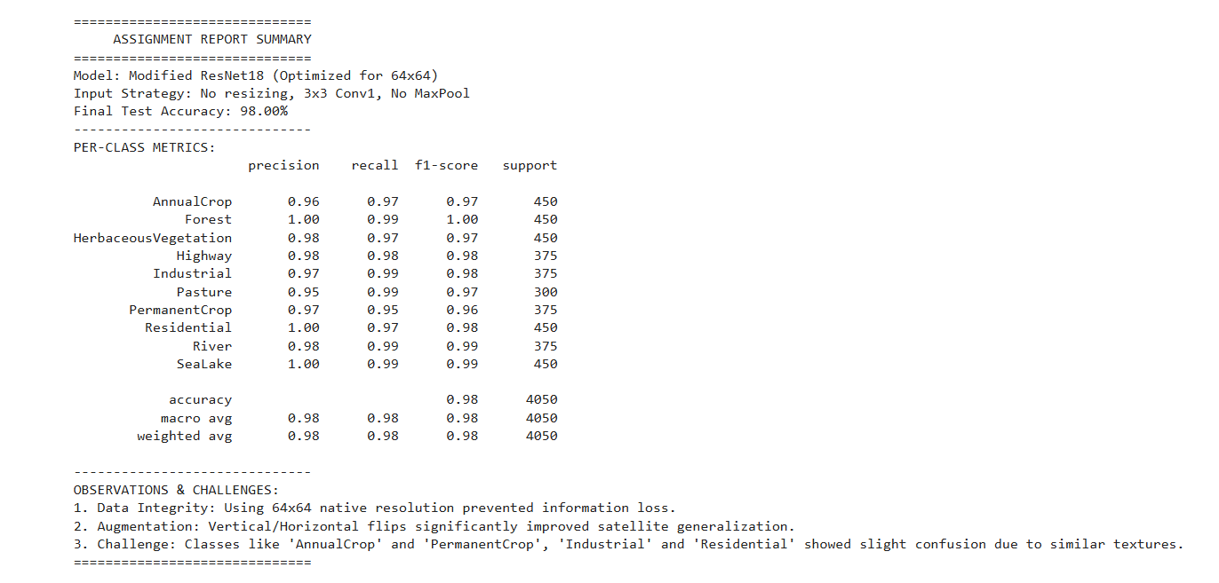
The modified ResNet18, stripped of its initial MaxPool layer and with a smaller 3×3 conv1 kernel, preserves spatial detail at the native 64×64 EuroSAT resolution. Trained with vertical and horizontal flip augmentation over 10 epochs, the model achieves 98% overall test accuracy. Per-class F1-scores exceed 0.93 for all categories, with minor confusion between visually similar classes such as AnnualCrop and PermanentCrop, and between Industrial and Residential patches.
Explore the full implementation, training pipeline, and evaluation scripts in the repository.
View on GitHub